With inlets, small islands, wetlands, sand dunes, lagoons, and an astounding variety of plants and animals, Narawntapu National Park is a calm coastal haven.
Narawntapu, on Tasmania’s central north coast, spans from Greens Beach at the Tamar River’s mouth to Bakers Beach in the west, and is one of the greatest areas in the state to see free-ranging species.
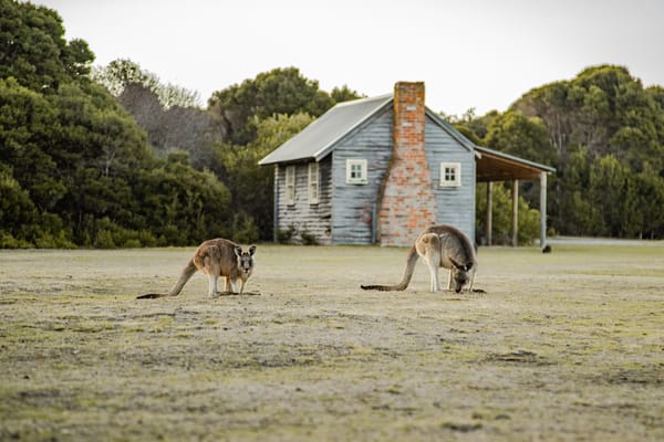
Forester kangaroos, Bennetts wallabies, and wombats are among the many easily spotted species that come out in the dusk to graze on the grasslands. Listen for Tasmanian devils’ growls and screeches.
Honeyeaters, rosellas, black cockatoos, and a variety of twittering robins are among the birds that congregate in the park. Water birds abound on Springlawn’s coasts and lagoons, and can be easily watched from a bird hide. The endangered Tasmanian wedge-tailed eagle feeds in the park, and white-bellied sea eagles can sometimes be seen swooping overhead.
Many shell middens and artefacts may be viewed on walking routes throughout Narawntapu National Park, which is rich in Aboriginal heritage.
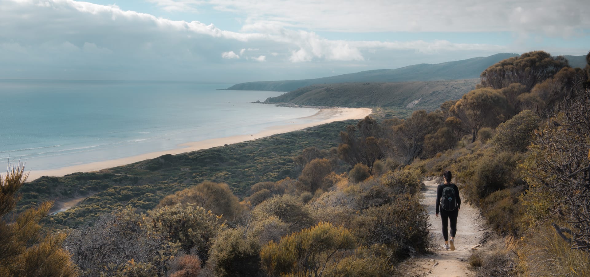
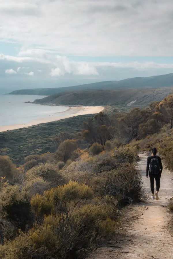
Full-day treks offer spectacular coastline vistas, dramatic terrain changes, and a diverse range of wildflowers and unusual plants including club moss and prickly tree fern.
Take the long and accessible climb to Point Vision for the best views of the surrounding area. There’s also a 26-kilometre horseback riding track with overnight holding yards.
Interpretive displays, picnic areas, a kiosk, and restrooms are all available at Springlawn’s visitor centre. Discovery rangers offer a varied programme of walks, talks, and other activities for children and adults during most summer vacations.
Key Information for Visiting Narawntapu National Park
Directions
The Narawntapu National Park is on the northern coast of Tasmania, slightly east from Devonport and close to the opening of the Tamar River to the east.
From Devonport, it’s a 41 kilometre drive. Head east along Frankford Road then left onto Bakers Beach Road. From Launceston, it’s a 76 kilometre drive. Head north-west along West Tamar Highway, then left onto Bridgenorth Road, right onto Long Plains Road, left onto Frankford Road and right onto Bakers Beach Road.
Facilities
The pleasant personnel at Springlawns’ Visitor Centre can provide information about local birds and animals, hiking, camping, fishing, beach use, and other topics to help you get the most out of your visit to the Park. There is also a modest souvenir shop with a limited number of kiosks and a small range of books. Snacks and beverages, as well as bait and ice, are available for purchase. It takes 25 minutes to get to the nearest store and gas station.
A short drive via the main Park gate, near the Springlawn campsite, will bring you to the restrooms and Visitor Center. There are no other restrooms along the walking paths.
The Springlawn Visitor Centre is where park passes and camping fees can be purchased. Self-registration facilities are available at the Visitor Centre and West Head for after-hours campers, but cash is required.
Springlawn, the Horse Yards, Bakers Point, and Koybaa campgrounds all have water available from tanks and bores. Because the water is untreated, it must be heated for several minutes before consumption. It is recommended that you bring your own drinking water. Bring a water jug with you. It should be noted that neither Badger Beach nor West Head provide drinking water. Along the walks, there is no constant supply of fresh water.
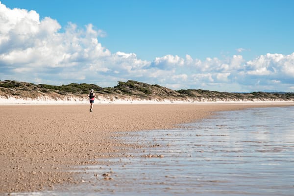
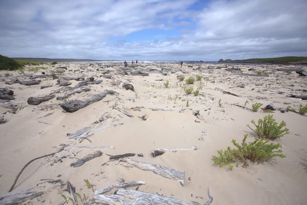
Bakers Beach in Narawntapu is popular for swimming and fishing, however none of the beaches are patrolled, and the ocean conditions can be unpredictable, so exercise caution at all times.
Only specified campgrounds and designated fireplaces are allowed to have campfires. During seasonal fire restrictions, campfires are prohibited.
History of Narawntapu National Park
Narawntapu National Park was previously known as Asbestos Range National Park until 1999. Small amounts of asbestos, as well as other minerals, were once mined in regions outside of the Asbestos Range, but never in the Asbestos Range itself, despite the park’s previous name. Because of its unusual coastal heathlands, importance as a habitat for native wildlife, and recreational value, Asbestos Range was designated as a national park in 1976.
Narawntapu is the Aboriginal name for the Badger Head and West Head areas inside the park, and it was the first park to revert to an Aboriginal name.
Shell middens, artefact scatters, and other sites in the park show that the area has a long Aboriginal heritage. Shellfish such as mussels, warrener, and limpets were a key element of the indigenous diet. The Aboriginal Heritage Act of 1975 protects these sites, which should be treated with respect. Today’s Aboriginal population visits the park on a regular basis, retaining a long history of connection to the park’s major sites.
Narawntapu National Park Walks
Visitors to Narawntapu will be rewarded with views of long sweeping beaches set against a unique Tasmanian coastal scenery as they walk through the park. Take a day trip to Archers Knob for the greatest views in the park, or take a stroll around Spring grass Nature Walk at night. Spend a more peaceful day beachcombing along Bakers Beach, then stay the night and experience some of Tasmania’s greatest camping.
Bird Hide Walk
The Bird Hide Walk is a short walk that takes you through banksia scrub and a towering paperbark swamp on a well-formed pathway. Keep a lookout for our local copperhead snakes as you stroll along the trail (especially during the summer). They prefer to stay cool and close to their food by sunbathing on the route or in the shade of the swamp. You can hear the sound of their prey when the small frogs call in the distance if you listen closely. You might also hear a ‘thump’ from the local pademelons and wallabies hiding and foraging in the bushes.
There is an addition to the symphony of the paperbark swamp, as life on the lagoon cries, with a little luck and good timing as you approach the bird hide. Ducks, herons, swans, cormorants, coots, bitterns, grebes, and a variety of other species can be seen from the hide depending on the time of year. Bring your binoculars, guidebooks, and a keen pair of eyes and ears, or simply take a leisurely stroll.
Archers Knob
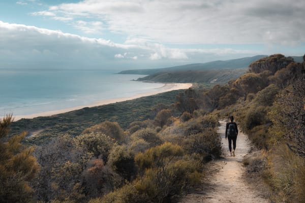
This walk features not only birds and a beach, but also a fantastic overlook with some of the Park’s best vistas. Meander through a paperbark swamp on a raised boardwalk from the visitor centre to the Springlawn bird hide. You might spot wallabies and pademelons among the trees, in addition to birds. Then it’s on to Archers Knob, which stands at 114 metres and is reached through a well-built zigzag trail. The beach, Springlawn, and beyond are all visible from this vantage point. Retrace your steps back to the visitor centre, or divert down the designated track to the magnificent beaches of Bakers Beach for a longer circle walk. Access track No. 3 via the road or track 1 through the bird hide to leave the beach. Both paths will return you to the visitor centre.
NOTE: Some wheelchair users may find the route to the Bird Hide to be suitable (with assistance). The rest of the walk to Archers Knob is inaccessible to wheelchairs.
Copper Cove & Badger Head
The Visitor Centre at Springlawn is the starting point for this lovely coastline stroll. You may get to Bakers Beach by following the Archers Knob Track from here. If you choose to take a detour to Archers Knob for the wonderful, panoramic views of the coast, your walking time will be extended by an hour.
A defined track zigzags up to Little Badger Head from Bakers Beach’s eastern end before descending into the isolated and lovely Copper Cove. At the headland, the track starts its journey to Badger Head, a small village. It’s about 6 kilometres from Bakers Beach’s eastern end to Badger Head.
Come prepared to enjoy the calm coastal waters of Badger Beach, which is a popular spot for swimming and line fishing.
You can also start this walk at Badger Head Settlement and travel in the opposite way down the track.
Springlawn, which is close to the Springlawn campsite, has the primary bathroom facilities.
Springlawn Nature Walk
Starting at the Springlawn Visitor Centre, this simple walk around the lagoon, passing through open grasslands and coastal vegetation on your way to the lagoon bird hide, before returning along calm boardwalks and dunes. As you follow the southern side of the lagoon, the open grasslands section of the track is unmarked. At dusk, this is the best area to see a forester kangaroo.
The bird hide is located in the lagoon’s paperbark forest and is an excellent site for birdwatching and photography. Pademelons, wallabies, and a variety of coastal birds such as oystercatchers, gulls, and terns use the surrounding beaches as a contrast habitat. Brown falcons, swamp harriers, and white-bellied sea eagles may be seen hunting for prey overhead.
At the start of the walk, at the Springlawn Visitor Centre and campsite, there are restrooms, picnic tables, and barbeque grills. All of these facilities are wheelchair accessible, although the walk is not because certain areas are sand dunes.
Point Vision Walk
At 370 metres, the Point Vision Track leads to the highest accessible summit in the Asbestos Ranges.
With steep inclines along the fire trail, this is a hike for the more experienced walker. Along the route, make sure to stop, rest, and take in the views of the Park and distant peaks.
The walk begins at the Springlawn Visitor Centre, where the amenities are located, and continues through Springlawn to the Asbestos Ranges’ foothills, where you will meet the fire trail. Before reaching the forested summit, you’ll pass through a range of flora types and cross occasionally rugged and steep terrain.
Walkers return to Springlawn by following the same path.
Animals you might see at Narawntapu National Park
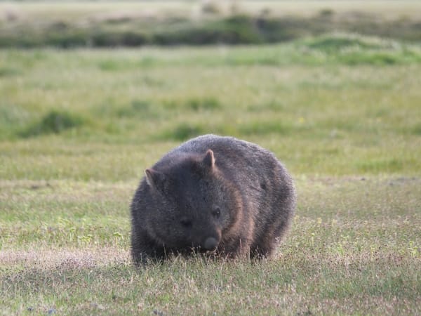
The nocturnal wanderings of the area’s marsupial residents bring Narawntapu to life around nightfall. The wide open spaces of the Springlawn region are ideal for tourists to observe the interactions of the native Forester kangaroos, Bennett’s wallabies, and pademelons.
Springlawn also boasts a diverse bird population, particularly in the area surrounding the wetlands. Several duck species, as well as herons, swans, cormorants, coots, bitterns, and grebes, visit the lagoon at different periods of the year. The bird hide is located near the lagoon’s edge and is only a short distance from the main park entrance. It’s a great place to sneak a peek at the local birdlife while learning more about the different species in the area.