Region: South-East Tasmania
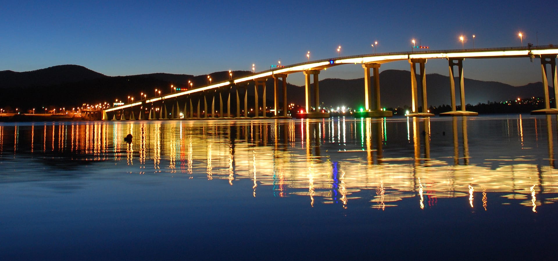
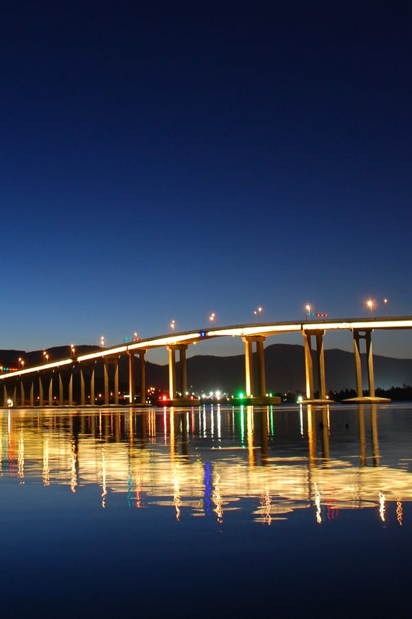
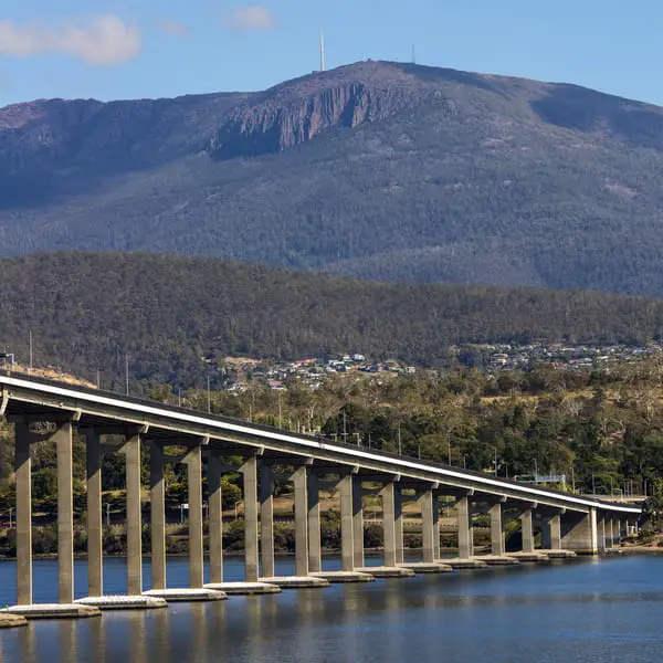
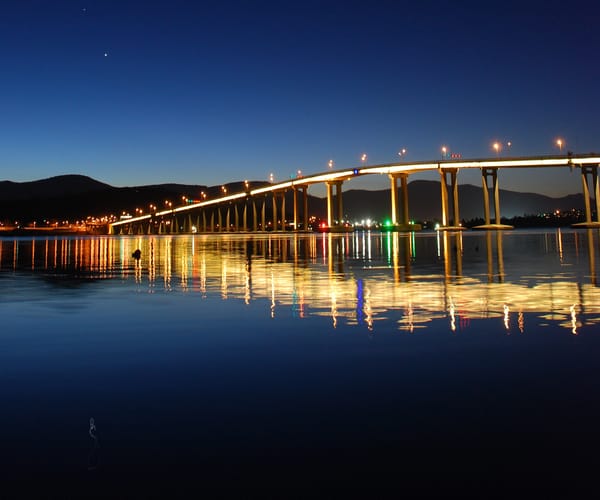
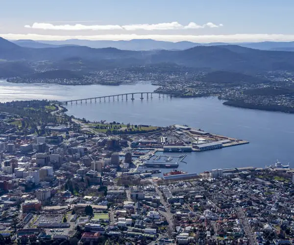
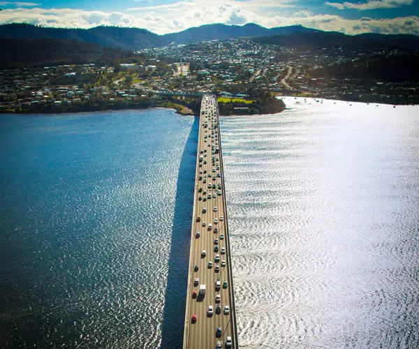
The Tasman Bridge is a five-lane bridge that spans the Derwent River at Hobart, Tasmania, Australia, near the city centre. The bridge is 1,395 metres long in total (including approaches) (4,576 ft). It connects the CBD (on the western side) to the eastern shore, Hobart International Airport and further locations such as the Tasman Peninsula.
There is a pedestrian walkway on each side, but no dedicated cycling lane. Steps to the pedestrian walkway, on the other hand, have lately been replaced with on-ramps.
The best places to view the Tasman Bridge include the Rosny Hill Lookout on the eastern shore, or from the top of Mount Wellington on the city side.
Tasman Bridge Construction & History
The Tasman Bridge was constructed due to two main reasons. The growth of the Eastern shore in the 1950s resulted in traffic congestion over the old Hobart Bridge. This lead to further disruptions to traffic when the bridge had to be frequently raised to let tall ships underneath. A long term solution was needed.
The whole cost of the new bridge, including approach ramps and the Lindisfarne interchange, was estimated to be around 7 million pounds. The bridge was originally opened to traffic (2 lanes only) on August 18, 1964, after construction began in May 1960. On December 23, 1964, the bridge was completed. It first opened its doors on March 18, 1965.
Tasman Bridge Collapse
In 1975, a disaster occured which separated the city of Hobart and led to the unfortunate loss of lives. The bulk ore transport Lake Illawarra, bound for the Electrolytic Zinc Company with a cargo of 10,000 tonnes of zinc concentrate, struck the Tasman Bridge on Sunday, January 5, 1975, at 9:27 p.m. It caused two pylons and three sections of concrete decking to fall off the bridge, totalling 127 metres (417 feet), sinking the ship. When four automobiles drove over the collapsed sections before traffic was stopped, seven of the ship’s crewmen were murdered, and five motorists were killed.
A now iconic news photo that’s well known by Tasmanians shows a 3,000km old Holden Monaro GTS perched balancing on the cliff, alongside an earlier FB Holden station wagon.
The river’s depth at this point (35 metres (115 feet) is sufficient that the wreck of the Lake Illawarra lays on the bottom with a concrete slab on top of it, posing little danger to smaller vessels. Residents in Hobart’s eastern suburbs were cut off when a major artery link failed, turning a short drive across the Tasman Bridge into a 50-kilometre (31-mile) journey across the estuary’s next bridge at Bridgewater.
After the bridge fell, the only alternative vehicular crossing within Hobart was the Risdon Punt, a cable ferry that ran between East Risdon and Risdon, about five kilometres upstream from the bridge. Although boats offered service across the Derwent River, it was not until December 1975 that a single lane Bailey bridge was built for motorists, restoring some connectivity.
The small and limited ferry service that operated over the river had an instant boom following Hobart’s secession. The two ships of Tasmanian mariner Robert Clifford were in a prime position to render assistance. Shortly before the collision, he had introduced the locally-built ferries Matthew Brady and James McCabe to the river crossing from Hobart’s Central Business District to the eastern coast. The Cartela, a wooden vessel built in 1912, and other ships pressed into duty by the Tasmanian government quickly joined these two ships in ferrying thousands of commuters across the river.
Clifford’s organisation saw ferry business diminish swiftly when the Bridge was successfully rebuilt, but by that time he had moved into shipbuilding[citation needed]. Incat, his company, has successfully supplied warships to China and Europe, as well as building vessels for the US Navy. The corporation is one of Tasmania’s largest employers. In addition, on June 20, 2007, a crane toppled while working on the bridge and hung precariously for several hours off the side of the barricades.
The Tasman Bridge was rebuilt starting in October 1975. Improved safety measures are a key aspect of the renovation. Here are several examples: Large ships must now travel under the bridge somewhat to the west of the original primary navigation span. Personnel in charge of ships (or harbour pilots) must be trained and cleared before utilising an unique laser lighthouse that displays colours to indicate whether the ship should be directed left or right to reclaim the centre line. All road traffic has come to a halt as huge vessels pass beneath the bridge.
In addition to these new safety features, the bridge was modified to accommodate a fifth lane. The building of lane control systems, which would allow the new centre lane to function as a reversible lane, was part of this renovation. The system includes a traffic signal system and a sign above each lane, as shown in the image to the right. A pulley mechanism is used in conjunction with the traffic light system to pull the signs over their proper lanes on a regular basis.
During a.m. peak hours, the centre lane points towards the city side (or western shore), and during p.m. peak hours, it points back towards the eastern shore. During non-peak hours, the lane tends to point towards the eastern coast. The Tasman Bridge was repaired during a two-year period at a cost of $44 million. On October 8, 1977, the bridge reopened to the public.