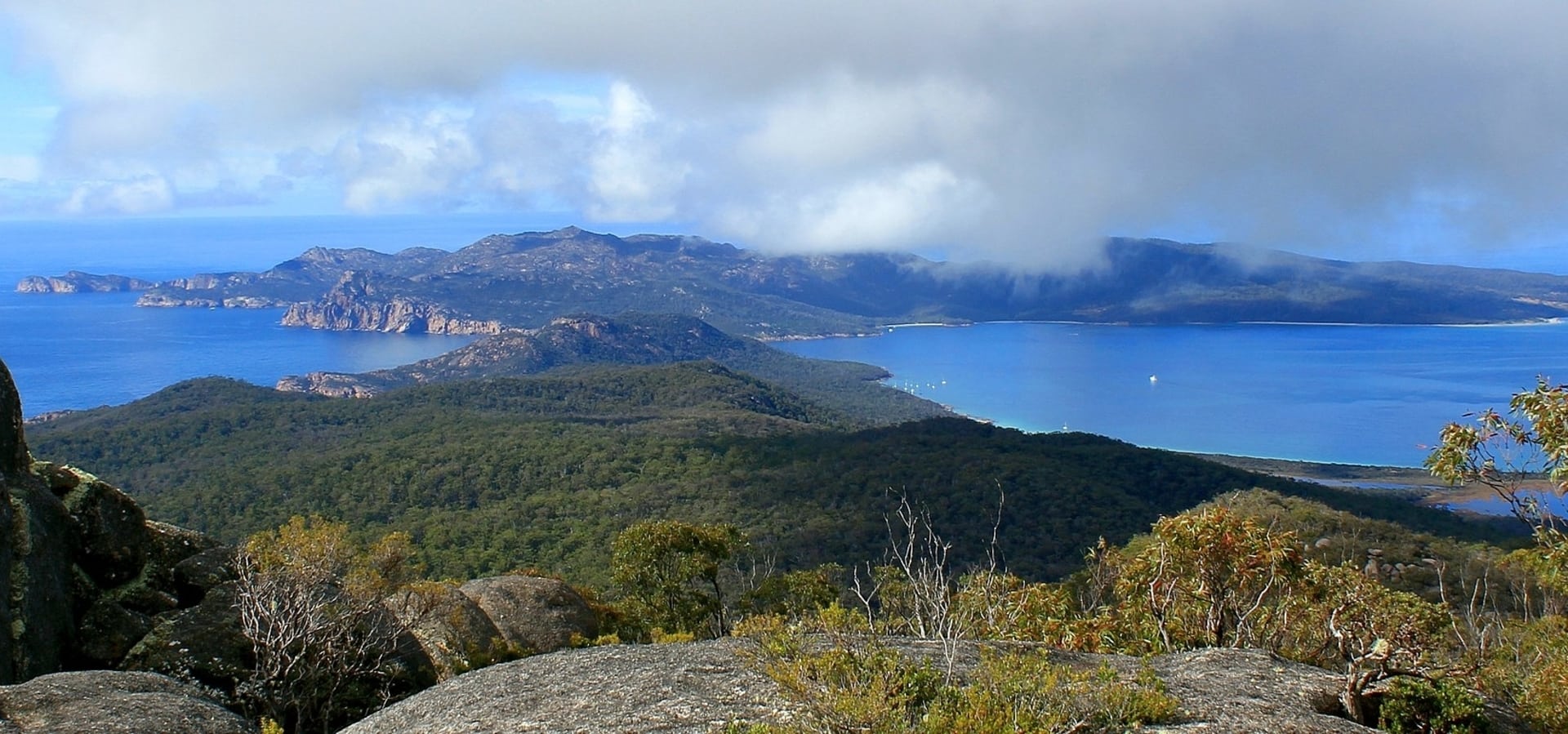
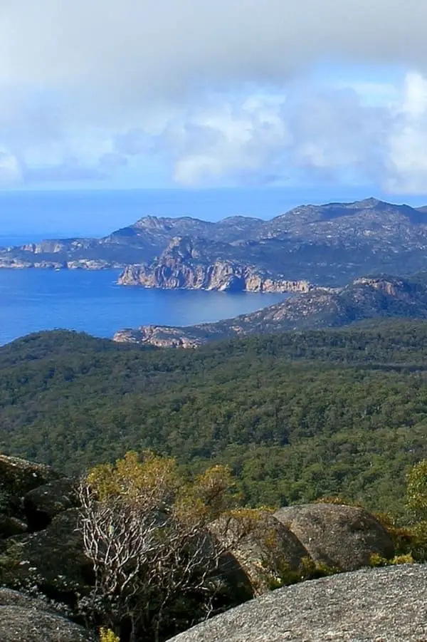
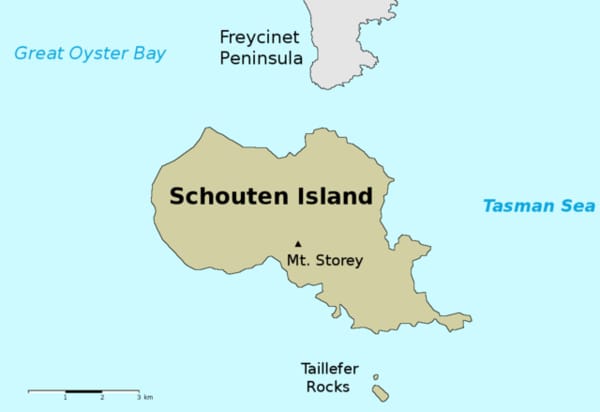
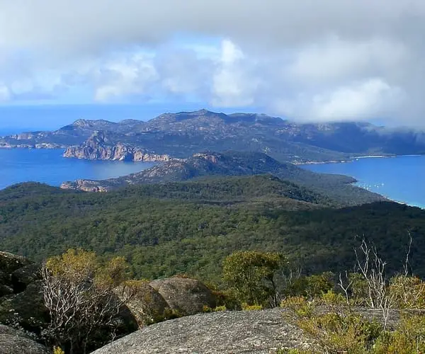
Schouten Island is an isolated sanctuary located just 1.6 kilometres south of Freycinet Peninsula and is ideal for snorkelling, kayaking, and camping. The island is about 6 kilometres broad by 7 kilometres long and is flanked by a scenic shoreline of little sandy beaches and rocky granite bays, all of which are part of Freycinet National Park.
Despite the fact that the island is popular with campers and kayakers, there is no habitation and no ferry service, adding to the impression of isolation and being alone with nature. Many portions of the island are accessible via walking paths. At Moreys Bay, there are huts besides a caretaker’s house. Crocketts Bay, which is close by, allows camping. Tours of the island’s shore are available, and boats may be leased from Coles Bay. The island is a 30-minute boat ride from Coles Bay settlement.
Getting to Schouten Island
Despite not being that far from Coles Bay and mainland Tasmania, in reality Schouten Island is it’s own separate little world. There are no regular scheduled ferries running to Schouten Island, if you don’t have a boat your best option is to book a trip with Freycinet Adventures, who do trips to Schouten Island on a 12 person ‘Aqua Taxi’.
This is a scenic and enjoyable experience, departing from the Coles Bay village, where it can stop off and give you a great look along the way at sights such as Hazards Beach and Cooks Beach. Visitors are dropped off at Crocketts Beach, a 30 minute boat ride from Coles Bay.
Schouten Island History
Schouten Island was one of the first geographical features in Tasmania to be called by a European, making it one of the oldest names still in use today. In December 1642, when cruising the east coast of Tasmania, Dutch explorer Abel Tasman called Schouten Island (Schouten’s Isle on an 1846 map) after Joost Schouten, a member of the Dutch East India Company’s Council, who was the first Dutch commander to traverse Cape Horn in 1610.
The nearby peninsula was once supposed to be made up of a chain of islands, but this myth was debunked during the arrival of French explorer Nicholas Baudin in 1802-1803
In 1802, members of the Baudin expedition arrived in Schouten. Sealers were active in the area in the early nineteenth century, and they are known to have visited the island. Around 1809, a sealer named John Stacey discovered coal on the island, which led to various phases of coal and tin mining, with a small group of Chinese workers working the ground for tin in 1880. 200-300 hectares of land could be appropriate for farming, according to Stacey. In the 1840s, there were plans to use convict labour to mine coal on the island, but they were never carried out.
As early as the 1850s, sheep and cattle were being grazed on areas of the Freycinet Peninsula. Until the 1960s, farming leases were also taken out on Schouten Island. The pastoral heritage of the island can be seen in huts near Moreys Beach, an old sheep dip, and abandoned farming machinery. Many sheep grazing leases were not renewed after their expiration date in 1969. Schouten Island was included to Freycinet National Park in 1977 after serving as a scenic reserve from 1916 to 1941 and then again from 1967.
Schouten Island Hiking & Things to Do
Schouten is a mountainous island with Mount Storey as its highest point (400 metres). Mt. Daedalus is the summit point of a large granite area on the island, and tiny tin mines can be found nearby. The island is encircled by cliffs with sheltered bays in between. The island is divided by a north-south fault line, with granite on the eastern side and dolerite on the western side atop sedimentary and supergroup rocks.
Scrubland, heathland, and sedgeland communities dominate the island’s natural vegetation on dolerite soils in the west, and eucalypt forest on granitic soils in the east. Grass and herbs predominate in areas affected by earlier human disturbance, such as clearing, grazing, and regular burning.
Little Penguins and Short-tailed Shearwaters, as well as other bird species such the Tasmanian Native-hen, breed on the island. On the eastern side, Australian Fur Seals congregate. The Tasmanian Tree Skink, She-oak Skink, Southern Grass Skink, and Three-lined Skink are among the reptiles present.
Schouten Island is a great place for hiking, especially if you like the idea of exploring the bush without crowds of people, which often happens on the more popular Freycinet walking tracks. The walk from Crocketts Beach to the top of Bear Hill is a short, enjoyable walk which is only about one hour return. An enjoyable and highly rewarding day walk is the Mount Storey and Mount Daedalus walk. This will take about 8 hours return.
Crocketts Beach offers crystal clear blue water and makes a nice place to snorkel and explore at a leisurely pace.
Taillefer Rocks
The Taillefer Rocks, part of the Schouten Island Group, are three small, craggy granite islets in the Freycinet National Park with a combined area of around 15 hectares (37 acres). Oyster Bay pines grow on this island, which is one of the few where they may be found. Little penguins, short-tailed shearwaters, fairy prions, and common diving petrels are among the seabird species that have been observed breeding. Metallic skinks, white’s skinks, spotted skinks, and mountain dragons are among the reptiles present. Small groups of Australian fur seals congregate there. A French expedition commanded by Nicolas Baudin named Taillefer Rocks on 28th February 1802. Hubert Jules Taillefer, the second doctor on the corvette Le Géographe, one of the expedition’s ships, was named after him.