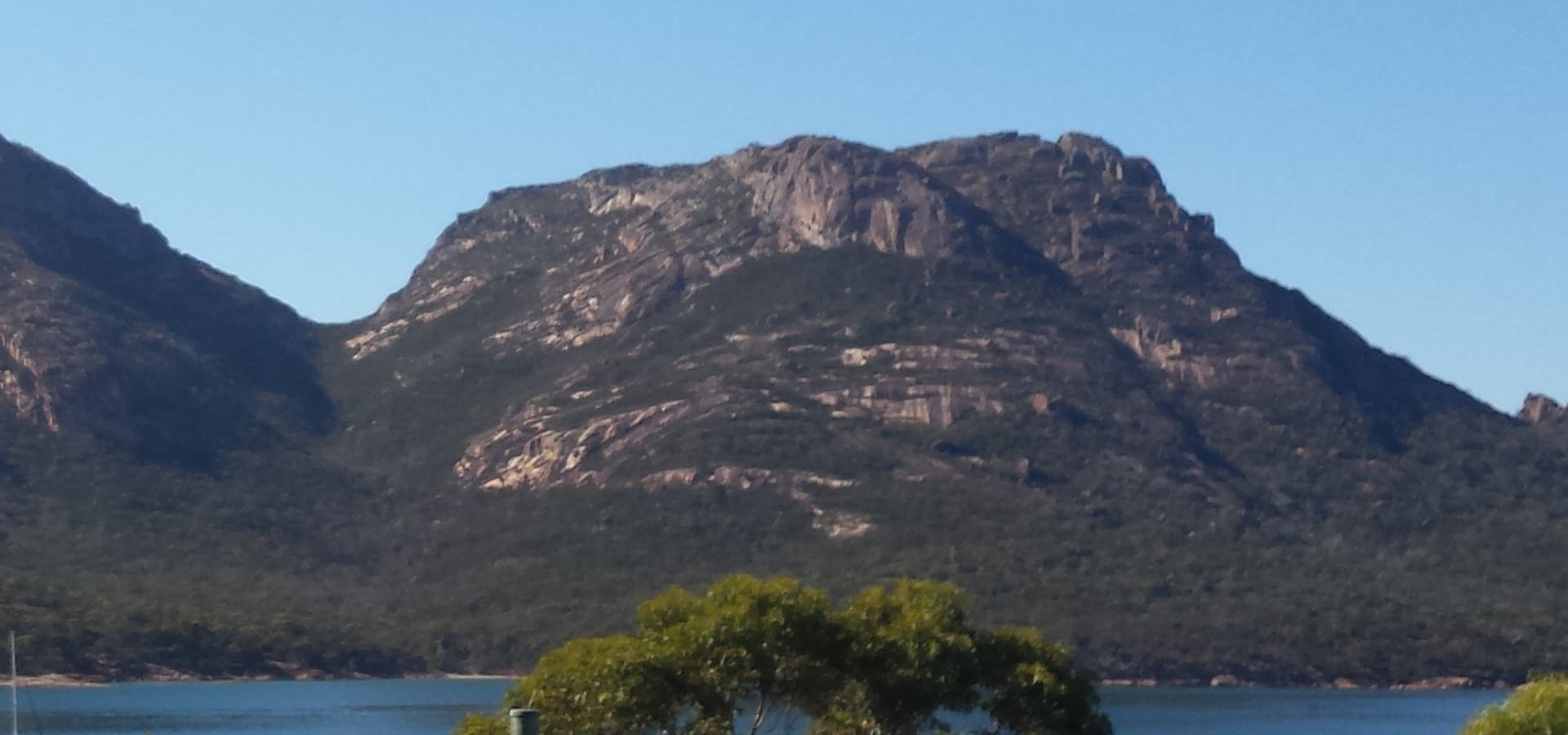
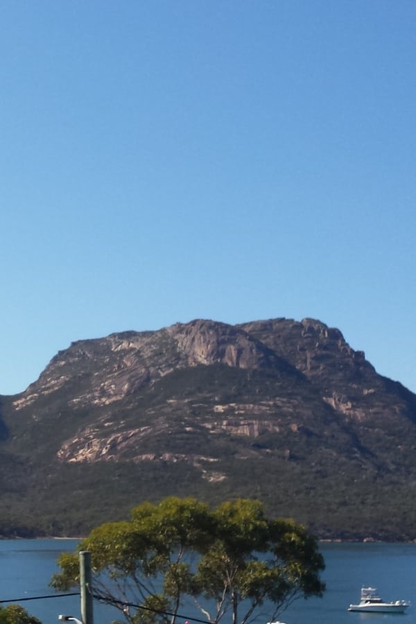
Mount Amos is part of the Hazards, a group of granite mountains that tower over Coles Bay and Freycinet National Park. The path to the peak is steep and difficult, but walkers are rewarded with spectacular views. If you’re looking at the Hazards from Coles Bay, Mount Amos is the second mountain from the right, the wide one with huge areas of granite boulders.
This trek is not suitable for the elderly or children under the age of ten. The track climbs sharply over sheets of exposed rock and can be treacherous, especially after rain. Walkers should wear sturdy walking shoes or boots. This track should be approached with caution.
Although a restroom is available at the carpark, there are no facilities along the trail.
Those who tackle the Mount Amos walk find the gruelling hike to the summit to be highly rewarding, the highlight of their trip to Freycinet National Park and a memorable moment.
Getting to Mount Amos Tasmania
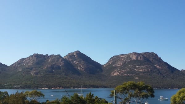
Mount Amos is in the Freycinet National Park, near the village of Coles Bay on Tasmania’s east coast, about 2.5 hours from Hobart and 2 hours from Launceston. You’ll notice some large granite mountains in the distance as you drive between Swansea and Bicheno, and you’ll turn off onto Coles Bay Road where you’ll drive heading in the direction of these mountains.
Once you reach Coles Bay, keep driving into the national park (purchase a park pass if you don’t have one) and drive to the walking tracks carpark at the end of the park. At the carpark there are toilets and a walker registration desk. For your safety it is asked that you list your details in the event that you’re unable to complete the walk and return home.
Mount Amos Walk – Summary & Safety Advice
This is a 3 hours round trip, 3.6km grade 4 hike. Experience with bushwalking is recommended. The track is long, rocky, steep and in parts the granite can be difficult to grip. As you’re climbing over large areas of granite, the track can be very unclear. Walkers are reliant on following markers which are placed every few metres.
This is a difficult trail that should only be attempted by physically fit and well-equipped walkers. When wet, the track crosses extremely steep and slippery rock slabs that are extremely dangerous. This walk should not be done if it is raining or likely to rain. The summit is exposed to the elements and is subject to changing weather. Hiking boots are strongly recommended, leave your flip flops at home! As the walk is open and exposed, it’s also recommended that you wear a hat and sunscreen, the sun can be reflective off the expansive rock areas.
It’s also important to bring drinking water on the walk as there is none available on Mount Amos. The taps at the walking tracks carpark, like the rest of Coles Bay, are untreated. It’s best to either boil and chill your own water or purchase bottled water in one of the Coles Bay shops.
What to Expect on the Mount Amos Walk
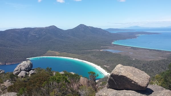
Now that the safety talk is done, let’s talk about the scenery and views. As the Mount Amos walk is steep and in most parts open, walkers get clear, unhindered views of Richardsons Beach, Coles Bay, Mures Beach, Swanwick, Great Oyster Bay and Friendly Beaches.
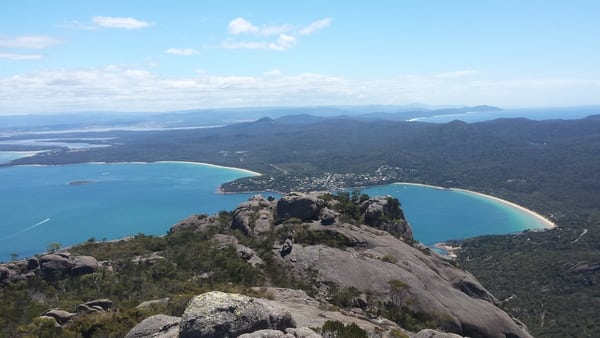
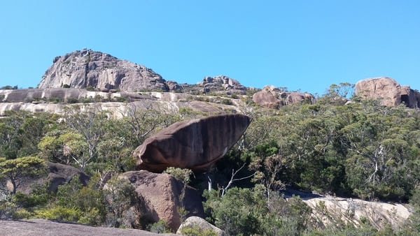
When you get to the top, you can admire the view from both sides of Mount Amos. This area is large and covered with trees and large boulders, some of which can be climbed. The very best photos you see of Wineglass Bay and the southern parts of Freycinet National Park, including Hazards Beach and Mount Graham mostly taken from here.
On a clear day these are some of the best views in Tasmania. It’s rare to find a walk which offers the freedom to go off-track without getting lost, it adds to the sense of adventure and creates a satisfying feeling when you find something new.